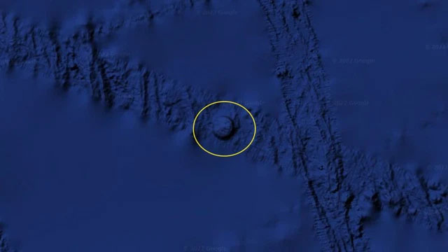
A recent image on Google Earth depicting a perfect circle amidst the vastness of the ocean has sparked discussions and controversy, thanks to Scott Waring, owner of a website specializing in “evidence” of extraterrestrial beings. The circular anomaly, resembling a mountain rising from the seabed, raises questions about the presence of unidentified flying objects (UFOs).

Situated off the coast near the Nazca Lines of Peru, known for colossal drawings created by the Nazca people nearly 2,000 years ago, this strange circular formation has captured the attention of Waring. Estimating its diameter at approximately 6.8km, visible from about 566km away from the Lima coastline, the circle seems to protrude from the ocean floor, reminiscent of a submerged mountain.

Despite the excitement among UFO enthusiasts, the circle is not evidence of extraterrestrial activity. It’s merely a result of Google’s data compilation process. Unusual shapes like this can emerge when data from various sources with different resolutions and details are stitched together. Google Earth relies on data from multiple sources to map the ocean, sometimes leading to peculiar shapes at merging points.

In a blog post in 2016, Google developers confirmed that data conflicts could lead to images resembling hills, valleys, and other anomalies on the map. For instance, ocean maps based on measurements from Scripps Institution of Oceanography utilize satellite gravity measurements to create a preliminary map of seabed elevation, showcasing ocean depth.

To achieve more detailed mapping, companies utilize sonar data from ships, a technique employing sound propagation to navigate, communicate, or detect objects underwater, recording echoes to create high-resolution images. Sometimes, measurements from satellites and ship-based surveys do not align seamlessly, resulting in formations resembling hills or depressions.
Significantly, the UFO identified by Waring lies precisely along a cross-section, an area presumably surveyed by sonar from ships. This peculiar shape could be an inadvertent outcome of merging various data sources. Such long lines are visible across the oceans on Google Earth and occasionally mistaken for signs of a lost civilization.
As of today, the majority of the ocean remains a mystery to humanity. According to the National Oceanic and Atmospheric Administration (NOAA), only 5% of the ocean has been mapped using modern sonar technology, leaving vast expanses unexplored. The Google Earth circle, initially perceived as a UFO, underscores the importance of scientific rigor in analyzing anomalies and highlights the ongoing mysteries within Earth’s oceans.

